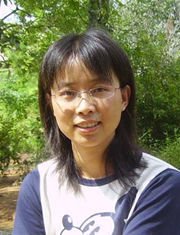
张秀英
| 张秀英 |
 |
张秀英.2000年毕业于兰州大学地理系经济地理与城乡区域规划专业,获学士学位;2003年,毕业于兰州大学资环学院自然地理专业,获硕士学位;2006年,毕业于南京大学地海学院地图学与地理信息系统专业,获博士学位。2006.7-2008.7浙江大学博士后研究;2008.8-2019.12,南京大学国际地球系统科学研究所讲师、副教授。2019.12以来,南京大学国际地球系统科学研究教授[1]。
目录
基本信息
人物说明----南京大学国际地球系统科学研究所教授
民 族 ---- 汉族
国 籍 ---- 中国
职 业 ---- 教育科研工作者
毕业院校----兰州大学地理系
研究方向
高分辨率图像信息提取;高光谱遥感;大气环境遥感。
科研项目
遥感科学国家重点实验室开放基金项目"亚热带典型植物酸雨胁迫的高光谱诊断研究(2010-2012)"
973项目子课题"中国酸雨时空动态及生态系统临界负荷空间分析(2007-2010)"
辽宁省环保局项目"辽宁省酸雨时空动态与成因的空间分析(2009-2010)"
发表论文
在《Environmental Pollution》、《Environmental Monitoring and Assessment》、《International Journal of Remote Sensing》、《遥感学报》、《自然资源学报》、《环境科学》等学术期刊发表论文30余篇,其中第一作者论文24篇,第一作者SCI索引论文9篇,第一作者EI检索论文8篇。近期代表作:
Zhang X.Y, Jiang H., and Wang Y.Q. Spatial variations of atmospheric methane concentrations inChina. International Journal of Remote Sensing (in press).
Zhang X.Y, Feng XZ, and Jiang H., Object-oriented method for urban vegetation mapping using IKONOS imagery. International Journal of Remote Sensing, 2010, 31(1), 177-196
Zhang X.Y., Zhong T.Y., Feng X.Z, and Wang K., Estimation of the relationship between vegetation patches and urban land surface temperature with remote sensing. International Journal of Remote Sensing, 2009, 30(8), 2105-2118.
Zhang X.Y., Zhong T., Wang K., and Cheng Z., Scaling of impervious surface area and vegetation as indicators to urban land surface temperature using satellite data. International Journal of Remote Sensing, 2009, 30 (4), 841-859.
Zhang X.Y, Lin F.F., Jiang Y.G., Wang K.,Wong M.T.F., Assessing soil Cu content and anthropogenic influences using decision tree analysis. Environmental Pollution, 2008, 156, 1260-1267.
参考来源
- ↑ 南京大学地理与海洋科学学院导师教师师资介绍简介-张秀英 ,南京大学, 2021-02-16